This sector is the south-eastern part of the Defence Line.
 Sectordepot Ouderkerk, Materials Division Sectordepot Ouderkerk, Materials Division
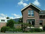
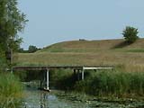
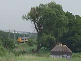
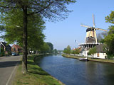
Located along the river Bullewijk, close to the river Amstel, near the village Ouderkerk. Used for the storage of artillery and other materials.
Partly dismantled except an official residence and a 1930's ammunition depot.
 Show map Show map
|
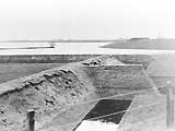
 Sectordepot Ouderkerk, Ammunition Division Sectordepot Ouderkerk, Ammunition Division
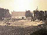
An older fort of the Defence Line's predecessor was used for the storage of ammunition for this sector.
Originally built to block the new road and railway from Amsterdam - Utrecht but the bombproof barrack toppled into the wet moat and were never rebuilt. Used as military storage depot until 1968 when it was demolished.
Show map |
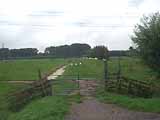
 Kudelstaart - Uithoorn Line Kudelstaart - Uithoorn Line
Existing dikes were adapted for military use between 1891 and 1895. Six earth batteries, a military road and a sluice were built during this time.
One of the batteries is mostly intact, while three others are barely distinguishable from earth heaps. The sluice and military road are also still in existence.
Show map |
 Advanced Defence along the Drecht Advanced Defence along the Drecht
While the Advanced Defence at Vijfhuizen had concrete shelters, this defence had only earth strong points for infantry supported by machine guns and canons. The strong points and canon emplacements would be prepared during a mobilisation only. Along the river Drecht for ten kilometres the strong points would both allow a forward defence and accept retreating forces into the Defence Line. There are no known remains.
Show map |
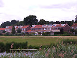
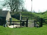
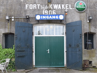 Fort near De Kwakel Fort near De Kwakel
Completed in 1907 with bombproof buildings. Was located in a forward position into the inundation area to have no houses in front.
Now surrounded by the village De Kwakel and the terrain is also used for housing. The fort watchmen's house and engineering shed are converted into houses.
Show map |
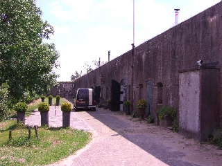
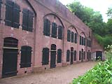
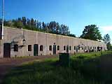 Fort along the Drecht Fort along the Drecht
Bombproof buildings were constructed between 1908 and 1912. Because of it's location in a bend of the Defence Line, it has only one gorge-side casemate to support the two other forts on either side.
Now in use as restaurant, gallery and workshops.
Show map |
 Fort near Uithoorn Fort near Uithoorn
Completed in 1911, had a defensive task until 1959 but used by the Army until 1997. Two railways ran close to the fort (closed in 1936 and 1980's).
Now owned by the National Forest Service.
Show map |
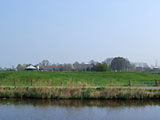
 Fort Waver-Amstel Fort Waver-Amstel
Located on the cross-roads of the rivers Amstel en Oude Waver. Completed in 1912 to defend a large area which could not be inundated and a barrage-sluice in the Oude Waver.
Show map |
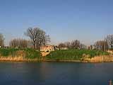
 Fort in the Botshol Fort in the Botshol
Unfinished fort shows the situation as planned for in "Het Kleine Plan" (The Small Plan, an interim version of the forts). Defendable earthworks of 1895-1896 were never completed with bombproof buildings.
Show map |
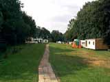 Fort along the Winkel Fort along the Winkel
Also unfinished fort with the defendable earthworks of 1895 flattened and removed.
Now in use as a camping-site for (retired) military personnel.
Show map |
 Fort near Abcoude Fort near Abcoude
The oldest, land based fort of the Defence Line. The bombproof buildings were built between 1884 and 1887 of both old style brick and modern concrete.
Show map |
 Batteries along the Gein Batteries along the Gein
Two batteries at each side of the river Gein with earth ramparts. Build in 1810 for the predecessor but from 1887 on part of the Defence Line.
Show map |
 Geindijk - Nigtevecht Line Geindijk - Nigtevecht Line
Earth rampart of approx. 1.2 kilometres length providing a covered way between de liver Gein with the Batteries along the Gein and the Fort near Nigtevecht. Near the fort is a concrete secondary battery with four positions for guns. The west half is also an inundation dike.
Show map |
 Fort near Nigtevecht Fort near Nigtevecht
Completed in 1904 with bombproof buildings. It lies along the current Amsterdam-Rhine Canal to block its dikes and protect the sluices near the village of Nigtevecht. Now a nature reserve.
Show map |
 Fort near Hinderdam Fort near Hinderdam
Brick building build in 1848 and 1880. First military works date from 1629. It is located on an island in the river Vecht.
Originally part of the New Dutch Waterline and transferred to the Defence Line in 1913.
Show map |
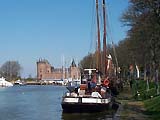
 Fort Uitermeer Fort Uitermeer
Entrenchment build in 1589 and earth fort in 1673. Brick tower fort build in 1845 with many additions until 1939.
Originally part of the New Dutch Waterline and transferred to the Defence Line in 1913.
Show map |
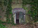
 Fieldstronghold Uitermeer Fieldstronghold Uitermeer
In addition to the Uitermeer Casemates, thirty one group shelters to house thirteen soldiers each where constructed during the mobilisation of 1939-1940. They provided shelter for the men operating the machine guns and canons in the open earth walls. The earth walls have since disappeared but the shelters and a tank barrier remain standing.
Show map |
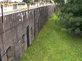
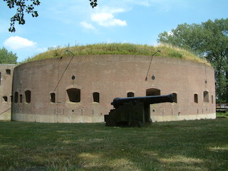
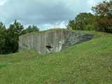
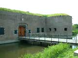
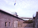
 Uitermeer Casemates Uitermeer Casemates
Six casemates were built to defend the road, rail and waterway accesses near Fort Uitermeer. The concrete casemates, mainly intended for machine guns, were built between 1932 and 1940. One casemate with an iron cast protection of 14 cm thick is one of the seven remaining of the initial 702 built.
Show map |
 Weesp Fortress Weesp Fortress
Weesp had its first rampart in 1355. Nothing remains of the stone city wall which was built in 1530 but demolished in parts in the 18th century.
Four of the eight planned bastions were constructed to protect the east and south side of the town. The bastions had canon shelters, of which two remain, and many canon emplacements in the earth wall.
Originally part of the New Dutch Waterline and transferred to the Defence Line in 1892.
Show map |
 Weesp Fortress - Weesp Fortress -
Defensive Tower on the Ossenmarkt
The tower fort was completed in 1861 with later a protective earth rampart which was removed again in 1983-1985.
Show map |
 Weesp Fortress - Weesp Fortress -
Battery De Roskam
The original battery dates from 1787 but in disuse in 1923. Purpose was to defend the back of the Weesp Fortress: the river Smal Weesp and its dikes.
The area was sold in 1924 and partly used for housing and again in 1998.
Show map |
 Uitermeer - Hakkelaarsbrug Line Uitermeer - Hakkelaarsbrug Line
This line is the main defence line since 1915, it replaced the line Weesp - Muiden, and was equipped with field batteries.
Show map |
 Hakkelaarsbrug Casemates Hakkelaarsbrug Casemates
Highway 1, between Amersfoort and Amsterdam enters the area of the "Fortress Holland" as an additional access point. Three concrete casemates, housing one canon and two machine guns, were built in 1931 to defend this access to the first line. The canon casemate has since been demolished.
Show map |
 Muiden Casemates Muiden Casemates
Highway 1, between Amersfoort and Amsterdam enters the area of the "Fortress Holland" as an additional access point. Three concrete casemates, housing one canon and two machine guns, were built in 1931 to defend this access to the second line. One machine gun casemate has since been demolished.
Show map |
 Position at Muiderberg Position at Muiderberg
To deny access over the sea dike, and because the Fort near Muiderberg wasn't built yet, many trenches and earth gun emplacement were constructed during the Great War. During the mobilisation of 1939-1940 many concrete shelters and a few road blocks were constructed.
The area is now used for housing with the two road blocks and many concrete shelters remaining.
Show map |
 Fort near Muiderberg Fort near Muiderberg
Construction started in 1913 but was aborted when the Great War started. A battery protected the sea dike instead of a fort as a advanced position of Muiden Fortress.
The area is now used for housing and nothing remains.
Show map |
 Muiden Fortress Muiden Fortress
Stronghold in 1280 for Count Floris V with most current works from 1851 or later. Mainly a rampart, one fort, four casemates and bombproof barrack.
Originally part of the New Dutch Waterline and transferred to the Defence Line in 1892.
Show map |
 Muiden Fortress - Muizenfort Muiden Fortress - Muizenfort
Brick fort which was build during the campaign of 1875-1880. The casemates on the two sites of the fort covered the area in front of the wall of Muiden Fortress. Forward firing guns would have been in the open air on top of the earth rampart.
Show map |
 Muiden Fortress - West Battery Muiden Fortress - West Battery
A 1799 battery was replaced in 1852 with the current brick tower fort. Located near the mouth of the river Vecht in the Zuiderzee (Southern Sea). Main task was to prevent landings.
Show map |
 Battery near Diemerdam Battery near Diemerdam
First battery on this location in 1787 but redone in 1810 but most current ammunition buildings and guns emplacements from 1889 and 1896. Task was to protect Amsterdam from attacks from the Soutern Sea in co-operation with Fort along Pampus and the Battery near Durgerdam.
Show map |
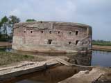
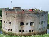
 Fort along Pampus Fort along Pampus
Unique island-fort which was completed in 1895 but went out of use in 1932. Oval shaped main building with dry moat and originally two turrets with each two gun. See Battery near Diemerdam for task description.
Show map |
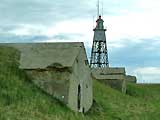 Battery near Durgerdam Battery near Durgerdam
Original battery dates from 1809 on the artificial lighthouse island of 1701. Current ammunition buildings and guns emplacements from 1887 and 1889. See Battery near Diemerdam for task description.
Show map |
|

")